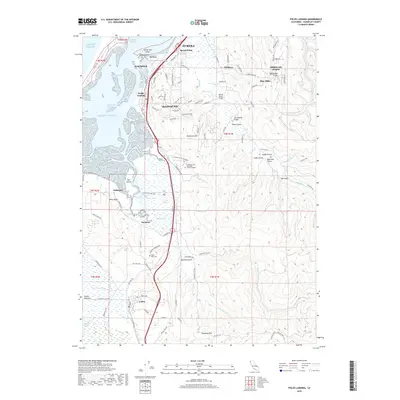
2018 Map of Fields Landing
USGS Topo · Published 2018About this map
Humboldt Bay and its complex marshlands dominate this landscape south of Eureka, where the Northwestern Pacific RR follows the coastline through Fields Landing and Spruce Point. The coastal geography is defined by a series of distinct points and channels, including Buhne Point, Hookton Channel, and the expanse of Southport Channel. Inland, the terrain rises toward Humboldt Hill and Tompkins Hill, punctuated by numerous named gulches like Deering Gulch and Railroad Gulch. Local history is anchored by the Table Bluff Cem and the College of the Redwoods, while the southern reaches transition into the dairy lands of Loleta and the Loleta Bottoms. The intricate network of Salmon Cr and Hookton Slough illustrates the delicate interface between the Pacific Ocean and the terrestrial drainages of the Elk River.
Find a feature on this map
94 named features on this map. Tap any name to fly to it.
Don’t see what you’re looking for? This feature index may not catch every label — zoom into the map to look around manually.
Map Details
Editions of this 2018 Fields Landing Map
This is the sole edition of this map. No revisions or reprints were ever made.
Other maps of this area

1916 · Cape Fortunas
USGS Topo · 1:62,500

1922 · Eureka
USGS Topo · 1:62,500

1933 · Eureka
USGS Topo · 1:48,000

1942 · Eureka
USGS Topo · 1:62,500

1943 · Ferndale
USGS Topo · 1:62,500

1944 · Fortuna
USGS Topo · 1:62,500

1949 · Eureka
USGS Topo · 1:250,000

1951 · Eureka
USGS Topo · 1:62,500

1951 · Ferndale
USGS Topo · 1:62,500
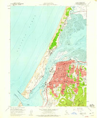
1958 · Eureka
USGS Topo · 1:24,000