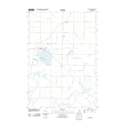
2011 Map of Fife Lake
USGS Topo · Published 2011About this map
Fife Lake serves as the focal point of this northern Michigan landscape, where the islands of Helen Island and Florence Island punctuate the deep blue waters. The village of Fife Lake is established on the northern shore, anchored by civic and community sites such as the Fife Lake Post Office and Saint Aloysius Cemetery. The surrounding terrain is a mosaic of smaller water bodies, including Mirror Lake and Pickerel Lake, which feed into the Fife Lake Outlet and eventually reach the southern winding course of the Manistee River.
Find a feature on this map
79 named features on this map. Tap any name to fly to it.
Don’t see what you’re looking for? This feature index may not catch every label — zoom into the map to look around manually.
Map Details
Editions of this 2011 Fife Lake Map
This is the sole edition of this map. No revisions or reprints were ever made.
Other maps of this area

1954 · Traverse City
USGS Topo · 1:250,000

1956 · Kalkaska
USGS Topo · 1:62,500

1956 · Fife Lake
USGS Topo · 1:62,500

1956 · Cadillac North
USGS Topo · 1:62,500

1956 · Lake City
USGS Topo · 1:62,500

1958 · Traverse City
USGS Topo · 1:250,000

1983 · Cadillac
USGS Topo · 1:100,000

1983 · Manton
USGS Topo · 1:25,000

1983 · Traverse City
USGS Topo · 1:100,000
1983 · Morey
USGS Topo · 1:25,000
Featured Places
- Fife Lake Township, MI
- Union Township, MI
- Fife Lake, Fife Lake Township
- Boardman Township, MI
- Bloomfield Township, MI