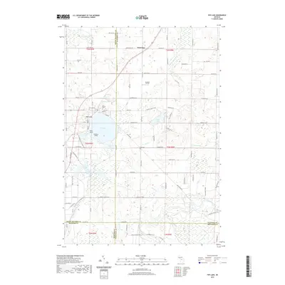
2019 Map of Fife Lake
USGS Topo · Published 2019About this map
Fife Lake sits at the center of this landscape, its waters broken by Helen Island and Florence Island. The village bordering the lake serves as a focal point where multiple county lines converge, including the boundaries of Grand Traverse, Kalkaska, Wexford, and Missaukee. The surrounding terrain is defined by a complex network of wetlands and watercourses, including the S Br Boardman River and Twenty-two Cr to the north, while the Manistee River flows along the southern edge. Local history is anchored by several sites of interest, such as the Fife Lake Cem and Saint Aloysius Cem near the town, and the more isolated Clark Cem further south. The presence of Tannehill Airfield and numerous recreational routes like the Shore to Shore Trail and the N Country Trail/Iron Belle Trail indicate a landscape heavily used for both transit and outdoor leisure in the modern era.
Find a feature on this map
110 named features on this map. Tap any name to fly to it.
Don’t see what you’re looking for? This feature index may not catch every label — zoom into the map to look around manually.
Map Details
Editions of this 2019 Fife Lake Map
This is the sole edition of this map. No revisions or reprints were ever made.
Other maps of this area

1954 · Traverse City
USGS Topo · 1:250,000

1956 · Kalkaska
USGS Topo · 1:62,500

1956 · Fife Lake
USGS Topo · 1:62,500

1956 · Cadillac North
USGS Topo · 1:62,500

1956 · Lake City
USGS Topo · 1:62,500

1958 · Traverse City
USGS Topo · 1:250,000

1983 · Cadillac
USGS Topo · 1:100,000

1983 · Manton
USGS Topo · 1:25,000

1983 · Traverse City
USGS Topo · 1:100,000
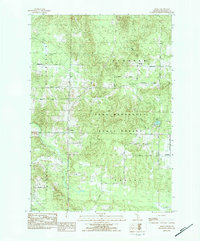
1983 · Morey
USGS Topo · 1:25,000
Featured Places
- Fife Lake Township, MI
- Union Township, MI
- Fife Lake, Fife Lake Township
- Boardman Township, MI
- Bloomfield Township, MI