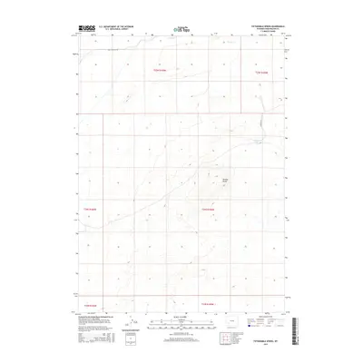
2015 Map of Fifteenmile Spring
USGS Topo · Published 2015About this map
Buffalo Hump dominates the central portion of this Sweetwater County landscape, providing a primary landmark in a region defined by high desert terrain and sparse water resources. The 2015 survey reveals a reliance on isolated water points like Fifteenmile Spring and the intermittent flow of Pacific Cr in the northern reaches. Movement through this section of Wyoming is facilitated by a grid of secondary routes, notably Eden Ryepatch Rd and Co Road 4-21, which navigate the public land survey system divisions. The map provides clear evidence of the vast, open-range character of the territory, where terrain features and named springs serve as critical navigational markers for ranching and resource management in the early 21st century.
Find a feature on this map
11 named features on this map. Tap any name to fly to it.
Don’t see what you’re looking for? This feature index may not catch every label — zoom into the map to look around manually.
Map Details
Editions of this 2015 Fifteenmile Spring Map
This is the sole edition of this map. No revisions or reprints were ever made.
Other maps of this area

1954 · Rock Springs
USGS Topo · 1:250,000

1955 · Lander
USGS Topo · 1:250,000

1958 · Lander
USGS Topo · 1:250,000

1958 · Rock Springs
USGS Topo · 1:250,000

1958 · Essex Mountain
USGS Topo · 1:62,500

1958 · Boars Tusk
USGS Topo · 1:62,500

1958 · Tule Butte
USGS Topo · 1:24,000

1961 · Lander
USGS Topo · 1:250,000

1962 · Rock Springs
USGS Topo · 1:250,000

1968 · Farson
USGS Topo · 1:24,000