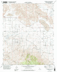
1971 Map of Fifteenmile Valley
USGS Topo · Published 1975About this map
The Granite Mountains dominate the northern landscape of this Mojave Desert quadrangle, where high desert terrain meets the expanding residential grid of Apple Valley. During the early 1970s, the desert floor shows a transition from undeveloped basin land to a structured network of named streets such as Del Oro Road and Loma Vista Road. The Atchison Topeka and Santa Fe Railroad cuts a diagonal path through the valley, serving as a primary transportation artery through Fifteenmile Valley. Local industry and topography are marked by features like the V P Mine and several Borrow Pits, while natural landmarks like Deadman Point and Chimney Rock provide distinct navigational points. To the east, the vast dry bed of Lucerne Lake anchors the drainage patterns that flow from canyons like Arrastre Canyon and Grapevine Canyon.
Find a feature on this map
55 named features on this map. Tap any name to fly to it.
Don’t see what you’re looking for? This feature index may not catch every label — zoom into the map to look around manually.
Map Details
Editions of this 1971 Fifteenmile Valley Map
2 editions found
Other maps of this area

1901 · Southern California Sheet No. 1
USGS Topo · 1:250,000

1902 · Deep Creek
USGS Topo · 1:62,500

1902 · San Gorgonio
USGS Topo · 1:125,000

1904 · Southern California Sheet No. 1
USGS Topo · 1:250,000

1932 · Barstow
USGS Topo · 1:125,000

1934 · Barstow
USGS Topo · 1:125,000

1947 · Lucerne Valley
USGS Topo · 1:62,500

1949 · Lucerne Valley
USGS Topo · 1:62,500

1953 · San Bernardino
USGS Topo · 1:250,000

1955 · Ord Mountains
USGS Topo · 1:62,500