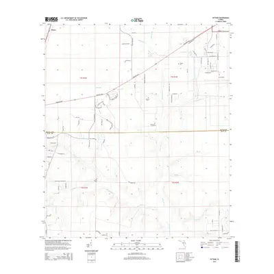
2015 Map of Fiftone
USGS Topo · Published 2015About this map
The Cecil Airport grounds dominate the northeastern corner of this Florida landscape, where aviation infrastructure meets the sprawling wetlands of the Westside. Situated along the boundary between Duval Co and Clay Co, the area is defined by a dense network of watercourses including Yellow Water Creek and North Fork Black Creek. These creeks wind through a mixture of timberlands and developing subdivisions, with the settlement of Fiftone positioned in the far northwest. Historically significant burial sites are scattered across the quadrangle, such as Whitker Cemetery, Manning Cemetery, and Deese Cemetery, providing essential touchstones for family historians. The primary corridor of Normandy Blvd cuts diagonally across the terrain, linking the rural creek bottoms with the more industrial and residential sectors bordering the airfield.
Find a feature on this map
80 named features on this map. Tap any name to fly to it.
Don’t see what you’re looking for? This feature index may not catch every label — zoom into the map to look around manually.
Map Details
Editions of this 2015 Fiftone Map
This is the sole edition of this map. No revisions or reprints were ever made.
Other maps of this area

1917 · Cambon
USGS Topo · 1:62,500

1917 · Macclenny
USGS Topo · 1:62,500

1918 · Middleburg
USGS Topo · 1:62,500

1918 · Lawtey
USGS Topo · 1:62,500

1918 · Cambon
USGS Topo · 1:62,500

1918 · Macclenny
USGS Topo · 1:62,500

1941 · Middleburg
USGS Topo · 1:62,500

1948 · Jacksonville
USGS Topo · 1:250,000

1949 · Middleburg SW
USGS Topo · 1:24,000

1949 · Fiftone
USGS Topo · 1:24,000