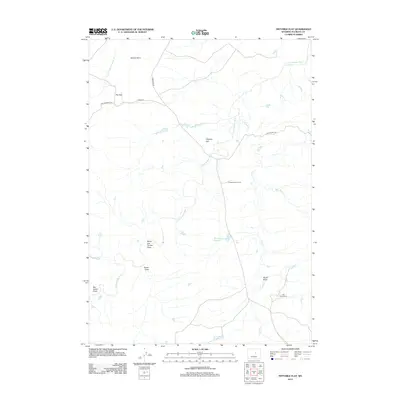
2012 Map of Fiftymile Flat
USGS Topo · Published 2012About this map
S Fork Powder River and its various tributaries, including Cloud Cr and Lone Tree Cr, define the drainage patterns of this high-plains landscape in Natrona County. Ranching infrastructure and remote camps are central to the human footprint here, as evidenced by Powder River Corral and the Jack Ellis Camp. A network of unpaved corridors like Harlan Ranch Rd and Lone Bear Rd provide the primary access to cattle operations and water management sites such as Blue Hill Reservoir.
Find a feature on this map
19 named features on this map. Tap any name to fly to it.
Don’t see what you’re looking for? This feature index may not catch every label — zoom into the map to look around manually.
Map Details
Editions of this 2012 Fiftymile Flat Map
This is the sole edition of this map. No revisions or reprints were ever made.
Other maps of this area

1955 · Arminto
USGS Topo · 1:250,000

1958 · Arminto
USGS Topo · 1:250,000

1962 · Arminto
USGS Topo · 1:250,000

1968 · Willow Creek School
USGS Topo · 1:24,000

1968 · Merino
USGS Topo · 1:24,000

1968 · Camel Hump Reservoir
USGS Topo · 1:24,000

1968 · Reynolds Reservoir
USGS Topo · 1:24,000

1968 · Big Sulfur Draw
USGS Topo · 1:24,000

1968 · Fiftymile Flat
USGS Topo · 1:24,000
1968 · Anderson Draw
USGS Topo · 1:24,000