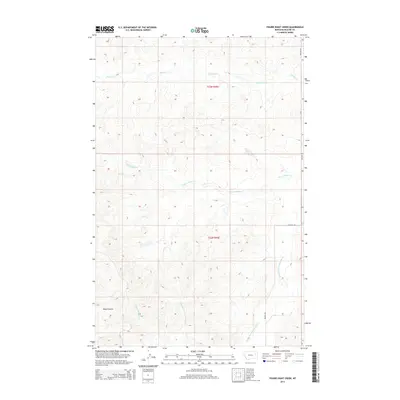
2014 Map of Figure Eight Creek
USGS Topo · Published 2014About this map
Figure Eight Creek defines the central drainage of this McCone County landscape, winding through a network of coulees and prairie waterways. The map illustrates a remote section of eastern Montana where water is the primary geographic marker, featuring the headwaters and tributaries of Middle Fork Prairie Elk Creek and Flying V Creek. This area remains largely defined by the Public Land Survey System, with the boundaries of t23n r45e and t22n r45e organizing the vast, open terrain. Transport is limited to primitive routes and the north-south corridor of Weldon Road, reflecting the sparse settlement patterns of the High Plains. Topographical features like Roald Coulee and Upper McGuire Creek provide specific landmarks for those tracing the hydrography or local ranching boundaries in this quiet corner of the state.
Find a feature on this map
8 named features on this map. Tap any name to fly to it.
Don’t see what you’re looking for? This feature index may not catch every label — zoom into the map to look around manually.
Map Details
Editions of this 2014 Figure Eight Creek Map
This is the sole edition of this map. No revisions or reprints were ever made.
Other maps of this area

1954 · Jordan
USGS Topo · 1:250,000

1954 · Glendive
USGS Topo · 1:250,000

1956 · Jordan
USGS Topo · 1:250,000

1957 · Glendive
USGS Topo · 1:250,000

1958 · Jordan
USGS Topo · 1:250,000

1958 · Glendive
USGS Topo · 1:250,000

1964 · Jordan
USGS Topo · 1:250,000

1973 · Crow Springs
USGS Topo · 1:24,000
1973 · Willis Buttes
USGS Topo · 1:24,000

1973 · Rodgers Hall
USGS Topo · 1:24,000