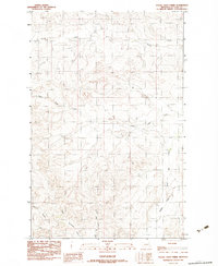
1983 Map of Figure Eight Creek
USGS Topo · Published 1983About this map
Flying V Creek and Figure Eight Creek define the complex drainage patterns of this McCone County landscape during the early 1980s. The terrain is characterized by a series of branching coulees and intermittent streams that feed into larger systems, including the Middle Fork Prairie Elk Creek and Elk Creek in the eastern portion of the quadrangle. In the southwestern corner, Roald Coulee and Upper Mc Guire Creek mark the topographic transitions of this ranchland environment. This provisional survey provides a precise look at the land's contours and natural watercourses before modern digital mapping, capturing the specific ranching and geological layout of the Big Dry country as it was understood in 1983.
Find a feature on this map
6 named features on this map. Tap any name to fly to it.
Don’t see what you’re looking for? This feature index may not catch every label — zoom into the map to look around manually.
Map Details
Editions of this 1983 Figure Eight Creek Map
This is the sole edition of this map. No revisions or reprints were ever made.
Other maps of this area

1954 · Jordan
USGS Topo · 1:250,000

1954 · Glendive
USGS Topo · 1:250,000

1956 · Jordan
USGS Topo · 1:250,000

1957 · Glendive
USGS Topo · 1:250,000

1958 · Jordan
USGS Topo · 1:250,000

1958 · Glendive
USGS Topo · 1:250,000

1964 · Jordan
USGS Topo · 1:250,000

1973 · Crow Springs
USGS Topo · 1:24,000
1973 · Willis Buttes
USGS Topo · 1:24,000

1973 · Rodgers Hall
USGS Topo · 1:24,000