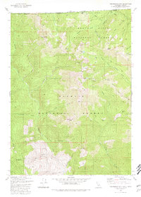
1980 Map of Figurehead Mtn
USGS Topo · Published 1981About this map
Figurehead Mtn stands as a central landmark within this 1980 survey, where the high-altitude boundaries of the Siskiyou National Forest, Rogue River National Forest, and Klamath National Forest converge at the Oregon-California border. The landscape is defined by its drainage systems, including the Middle Fork Applegate River and Thompson Creek, and is marked by numerous alpine features such as Azalea Lake and Lonesome Lake.
Find a feature on this map
45 named features on this map. Tap any name to fly to it.
Don’t see what you’re looking for? This feature index may not catch every label — zoom into the map to look around manually.
Map Details
Editions of this 1980 Figurehead Mtn Map
2 editions found
Other maps of this area

1908 · Grants Pass
USGS Topo · 1:125,000

1914 · Seiad
USGS Topo · 1:125,000

1922 · Seiad
USGS Topo · 1:125,000

1948 · Weed
USGS Topo · 1:250,000

1950 · Weed
USGS Topo · 1:250,000

1954 · Oregon Caves
USGS Topo · 1:62,500

1954 · Ruch
USGS Topo · 1:62,500

1955 · Seiad Valley
USGS Topo · 1:62,500

1955 · Medford
USGS Topo · 1:250,000

1956 · Happy Camp
USGS Topo · 1:62,500