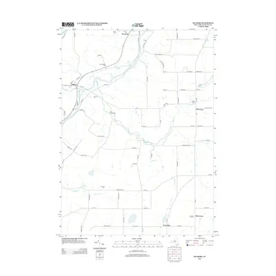
2013 Map of Fillmore
USGS Topo · Published 2013About this map
The Genesee River cuts a prominent path through this section of Allegany County, anchoring a landscape defined by small valley settlements and high upland farms. In the village of Fillmore, the street grid is well-defined near the confluence of Cold Cr, while the hamlet of Rossburg sits further north along the river's bend. The area's agricultural character is evident at Riverland Dairy Farms and the scattered rural hubs of Short Tract and Allen Center. For those researching local lineages, this survey is exceptionally detailed regarding burial sites, marking several historically significant locations such as Holy Cross Cem, Pine Grove Cem, and Basswood Hill Cem. The topography is further marked by numerous watercourses, including Wiscoy Cr and the winding path of Rush Cr, which is spanned by the Rush Creek Bridge.
Find a feature on this map
82 named features on this map. Tap any name to fly to it.
Don’t see what you’re looking for? This feature index may not catch every label — zoom into the map to look around manually.
Map Details
Editions of this 2013 Fillmore Map
This is the sole edition of this map. No revisions or reprints were ever made.
Other maps of this area

1905 · Portage
USGS Topo · 1:62,500

1905 · Nunda
USGS Topo · 1:62,500

1906 · Angelica
USGS Topo · 1:62,500

1916 · Canaseraga
USGS Topo · 1:62,500

1940 · Canaseraga
USGS Topo · 1:62,500

1941 · Angelica
USGS Topo · 1:62,500

1943 · Nunda
USGS Topo · 1:24,000

1943 · Portageville
USGS Topo · 1:24,000

1943 · Pike
USGS Topo · 1:24,000
1944 · Nunda
USGS Topo · 1:31,680