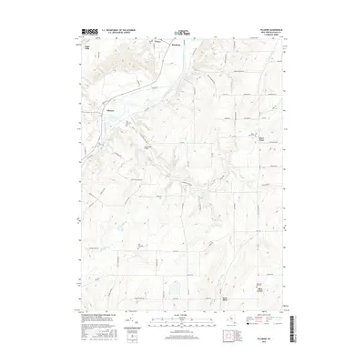
2016 Map of Fillmore
USGS Topo · Published 2016About this map
The Genesee River carves a deep valley through this portion of Allegany County, anchoring a series of small settlements and agricultural hamlets. The village of Fillmore serves as a primary hub, situated near the confluence of Cold Creek and the river. Northward, the landscape transitions into the smaller communities of Wiscoy and Rossburg, while the northernmost corner is marked by the distinctive naming of Mills Mills. These settlements are linked by a network of rural roads that climb the steep valley walls, revealing the region's historical reliance on river-bottom farming and small-scale water-powered industry.
Find a feature on this map
76 named features on this map. Tap any name to fly to it.
Don’t see what you’re looking for? This feature index may not catch every label — zoom into the map to look around manually.
Map Details
Editions of this 2016 Fillmore Map
This is the sole edition of this map. No revisions or reprints were ever made.
Other maps of this area

1905 · Portage
USGS Topo · 1:62,500

1905 · Nunda
USGS Topo · 1:62,500

1906 · Angelica
USGS Topo · 1:62,500

1916 · Canaseraga
USGS Topo · 1:62,500

1940 · Canaseraga
USGS Topo · 1:62,500

1941 · Angelica
USGS Topo · 1:62,500

1943 · Nunda
USGS Topo · 1:24,000

1943 · Portageville
USGS Topo · 1:24,000

1943 · Pike
USGS Topo · 1:24,000
1944 · Nunda
USGS Topo · 1:31,680