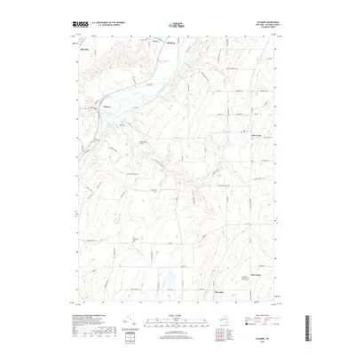
2019 Map of Fillmore
USGS Topo · Published 2019About this map
The Genesee River cuts a wide valley through northern Allegany County, anchoring a network of small agricultural hamlets and crossroads. The village of Fillmore sits at the confluence with Cold Creek, while further north, the water power once harnessed by early industry is reflected in the name of Mills Mills and the nearby settlement of Wiscoy. For genealogists, the map is a dense record of early community sites, preserving the locations of numerous burial grounds including Pine Grove Cem, Holy Cross Cem, and the East Caneadea Cem.
Find a feature on this map
86 named features on this map. Tap any name to fly to it.
Don’t see what you’re looking for? This feature index may not catch every label — zoom into the map to look around manually.
Map Details
Editions of this 2019 Fillmore Map
This is the sole edition of this map. No revisions or reprints were ever made.
Other maps of this area

1905 · Portage
USGS Topo · 1:62,500

1905 · Nunda
USGS Topo · 1:62,500

1906 · Angelica
USGS Topo · 1:62,500

1916 · Canaseraga
USGS Topo · 1:62,500

1940 · Canaseraga
USGS Topo · 1:62,500

1941 · Angelica
USGS Topo · 1:62,500

1943 · Nunda
USGS Topo · 1:24,000

1943 · Portageville
USGS Topo · 1:24,000

1943 · Pike
USGS Topo · 1:24,000
1944 · Nunda
USGS Topo · 1:31,680