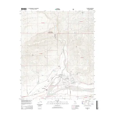
2015 Map of Fillmore
USGS Topo · Published 2015About this map
Fillmore sits at the southern edge of the steep Topatopa Mountains, where the wide Santa Clara River valley provides a level plain for agricultural and residential development. This modern survey shows the community’s layout near the confluence of the Sespe River, illustrating the shift from the high wilderness of Los Padres National Forest to the structured grid of the valley floor. Settlement is concentrated around several distinct neighborhoods, including North Fillmore, Oak Village, and Sespe Village, while smaller outposts like Keith and Sespe appear along the road and rail corridors.
Find a feature on this map
64 named features on this map. Tap any name to fly to it.
Don’t see what you’re looking for? This feature index may not catch every label — zoom into the map to look around manually.
Map Details
Editions of this 2015 Fillmore Map
This is the sole edition of this map. No revisions or reprints were ever made.
Other maps of this area

1900 · Piru
USGS Topo · 1:62,500

1903 · Santa Paula
USGS Topo · 1:62,500

1903 · Mt. Pinos
USGS Topo · 1:125,000

1903 · Tejon
USGS Topo · 1:125,000

1903 · Camulos
USGS Topo · 1:125,000

1921 · Piru
USGS Topo · 1:62,500

1941 · Piru
USGS Topo · 1:62,500

1942 · Santa Paula
USGS Topo · 1:62,500

1943 · Topatopa Mountains
USGS Topo · 1:24,000
1943 · Devils Heart Peak
USGS Topo · 1:24,000