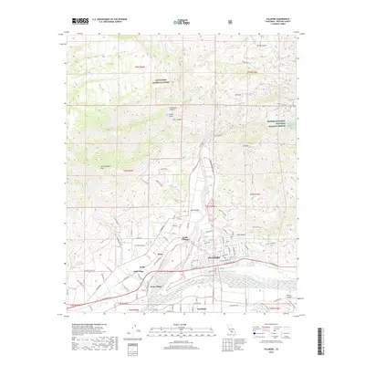
2018 Map of Fillmore
USGS Topo · Published 2018About this map
Fillmore serves as the focal point of this 2018 survey, situated where the Sespe Creek canyon opens into the wide Santa Clara River valley. The map documents the intricate grid of the town center, including streets like Main St and Central Ave, while also capturing outlying communities like Bardsdale to the south and Sespe Village to the west. This area is a significant agricultural corridor, evidenced by the numerous named ranch and canyon roads that branch off into the surrounding foothills.
Find a feature on this map
115 named features on this map. Tap any name to fly to it.
Don’t see what you’re looking for? This feature index may not catch every label — zoom into the map to look around manually.
Map Details
Editions of this 2018 Fillmore Map
This is the sole edition of this map. No revisions or reprints were ever made.
Other maps of this area

1900 · Piru
USGS Topo · 1:62,500

1903 · Santa Paula
USGS Topo · 1:62,500

1903 · Mt. Pinos
USGS Topo · 1:125,000

1903 · Tejon
USGS Topo · 1:125,000

1903 · Camulos
USGS Topo · 1:125,000

1921 · Piru
USGS Topo · 1:62,500

1941 · Piru
USGS Topo · 1:62,500

1942 · Santa Paula
USGS Topo · 1:62,500

1943 · Topatopa Mountains
USGS Topo · 1:24,000
1943 · Devils Heart Peak
USGS Topo · 1:24,000