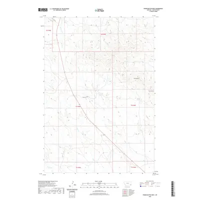
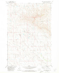
2020 Map of Finger Buttes West
USGS Topo · Published 2020About this map
The prominent ridge of Finger Buttes dominates this corner of Carter County, Montana, providing a natural focal point for the surrounding high plains. The landscape is defined by an intricate network of seasonal drainage systems, including Hawksnest Cr, Prairie Dog Cr, and the diverging branches of N Butte Cr and S Butte Cr. Human presence in this section of the state is sparse, represented primarily by specialized routes like Tauck Rd and the Finger Buttes Trl, which follow the natural contours of the terrain. The map illustrates the classic western survey grid through township boundaries such as t6s r59e and t6s r60e, showing how ranching and land management in this era adapted to the local hydrology of Hay Cr and Blacktail Cr.
Find a feature on this map
17 named features on this map. Tap any name to fly to it.
Don’t see what you’re looking for? This feature index may not catch every label — zoom into the map to look around manually.
Map Details
Editions of this 2020 Finger Buttes West Map
This is the sole edition of this map. No revisions or reprints were ever made.
Other maps of this area

1954 · Ekalaka
USGS Topo · 1:250,000

1956 · Ekalaka
USGS Topo · 1:250,000

1958 · Ekalaka
USGS Topo · 1:250,000

1965 · Ekalaka
USGS Topo · 1:250,000

1980 · Prairie Dog Creek
USGS Topo · 1:24,000
1980 · Alzada NW
USGS Topo · 1:24,000

1980 · Finger Buttes East
USGS Topo · 1:24,000
1980 · Albion
USGS Topo · 1:24,000
1980 · Lone Tree Creek
USGS Topo · 1:24,000
1980 · Finger Buttes West
USGS Topo · 1:24,000