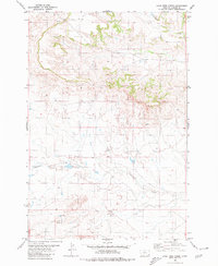
1980 Map of Lone Tree Creek
USGS Topo · Published 1980About this map
Lone Tree Creek and Cottonwood Creek dominate this landscape within Carter County, revealing a terrain defined by drainage patterns and sparse water sources. The map, based on 1970s aerial photography, highlights the importance of localized water access in this high plains region, marked prominently by a Spring and a Well in the northern sections. This detailed survey by the Department of the Interior captures the precise network of Hackberry Creek and its tributaries before the turn of the decade. The presence of numerous fence lines indicated by fine red dashes suggests a landscape primarily dedicated to ranching and open-range management, where traditional land divisions remained essential to the local economy and land use during the late twentieth century.
Find a feature on this map
6 named features on this map. Tap any name to fly to it.
Don’t see what you’re looking for? This feature index may not catch every label — zoom into the map to look around manually.
Map Details
Editions of this 1980 Lone Tree Creek Map
This is the sole edition of this map. No revisions or reprints were ever made.
Other maps of this area

1954 · Ekalaka
USGS Topo · 1:250,000

1956 · Ekalaka
USGS Topo · 1:250,000

1958 · Ekalaka
USGS Topo · 1:250,000

1965 · Ekalaka
USGS Topo · 1:250,000

1980 · Prairie Dog Creek
USGS Topo · 1:24,000

1980 · Cactus Creek West
USGS Topo · 1:24,000

1980 · Finger Buttes East
USGS Topo · 1:24,000

1980 · Belltower Butte
USGS Topo · 1:24,000
1980 · School Section Creek
USGS Topo · 1:24,000
1980 · Capitol NW
USGS Topo · 1:24,000