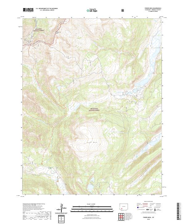
2022 Map of Finger Mesa
USGS Topo · Published 2022About this map
The Continental Divide bisects the high country of Hinsdale County in this 2022 survey, marking the primary hydrological boundary of the American West. To the north lies the Gunnison National Forest, while the southern slopes descend into the Rio Grande National Forest. This high-altitude landscape is defined by its drainage systems, where the headwaters of the Rio Grande and Ute Creek emerge. Recreationists and surveyors alike can trace the path of the Continental Divide National Scenic Trl as it winds along the ridge line, connecting with historic paths like the Lost Trl and Heart Lake Trl. Significant water features such as Heart Lake, the Pearl Lakes, and the Hermit Number 4 Reservoir highlight the region's importance for water management and high-alpine ecosystems. The namesake Finger Mesa stands as a prominent topographical landmark near Crooked Canyon.
Find a feature on this map
31 named features on this map. Tap any name to fly to it.
Don’t see what you’re looking for? This feature index may not catch every label — zoom into the map to look around manually.
Map Details
Editions of this 2022 Finger Mesa Map
This is the sole edition of this map. No revisions or reprints were ever made.
Other maps of this area

1905 · San Cristobal
USGS Topo · 1:125,000

1907 · San Cristobal
USGS Topo · 1:125,000

1945 · Durango
USGS Topo · 1:250,000

1953 · Durango
USGS Topo · 1:250,000

1954 · Durango
USGS Topo · 1:250,000

1959 · Bristol Head
USGS Topo · 1:62,500

1961 · Durango
USGS Topo · 1:250,000

1963 · Durango
USGS Topo · 1:250,000
1964 · Rio Grande Pyramid
USGS Topo · 1:24,000
1964 · Finger Mesa
USGS Topo · 1:24,000