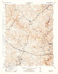
1944 Map of Finksburg
USGS Topo · Published 1944About this map
Sykesville and the expansive grounds of the Springfield State Hospital anchor the southern portion of this mid-century topographic study. The landscape is defined by the winding course of the North Branch Patapsco River and its numerous tributaries, including Morgan Run and Beaver Run, which historically powered local industry. Visible evidence of this water-driven economy remains in labels for the Springfield Roller Mills, Comet Roller Mills, and Bollinger Mills.
Find a feature on this map
43 named features on this map. Tap any name to fly to it.
Don’t see what you’re looking for? This feature index may not catch every label — zoom into the map to look around manually.
Map Details
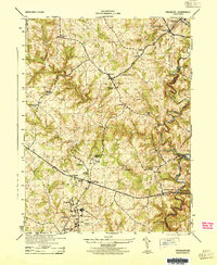
Editions of this 1944 Finksburg Map
2 editions found
Other maps of this area

1892 · Ellicott
USGS Topo · 1:62,500

1893 · Frederick
USGS Topo · 1:125,000

1894 · Ellicott
USGS Topo · 1:62,500

1894 · Frederick
USGS Topo · 1:125,000

1905 · Westminster
USGS Topo · 1:62,500

1906 · Ellicott
USGS Topo · 1:62,500

1908 · Patapsco
USGS Topo · 1:125,000

1909 · Mount Airy
USGS Topo · 1:62,500

1911 · Taneytown
USGS Topo · 1:62,500

1942 · Gettysburg
USGS Topo · 1:125,000