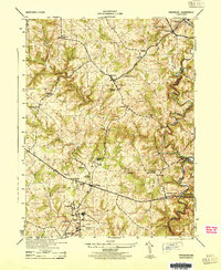
1944 Map of Finksburg
USGS Topo · Published 1944About this map
Sykesville and the expansive Springfield State Hospital grounds anchor the southern edge of this mid-1940s Carroll County landscape. The region's agricultural and industrial character is defined by a series of water-powered operations along the local waterways, including Comet Roller Mills near Finksburg and Springfield Roller Mills further south. These sites, along with Glee Mill and Bollinger Mills, illustrate a grain-processing economy reliant on the winding courses of Morgan Run and the North Branch Patapsco River.
Find a feature on this map
40 named features on this map. Tap any name to fly to it.
Don’t see what you’re looking for? This feature index may not catch every label — zoom into the map to look around manually.
Map Details
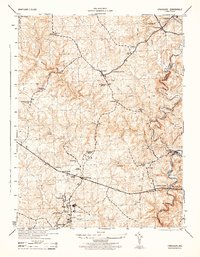
Editions of this 1944 Finksburg Map
2 editions found
Other maps of this area

1892 · Ellicott
USGS Topo · 1:62,500

1893 · Frederick
USGS Topo · 1:125,000

1894 · Ellicott
USGS Topo · 1:62,500

1894 · Frederick
USGS Topo · 1:125,000

1905 · Westminster
USGS Topo · 1:62,500

1906 · Ellicott
USGS Topo · 1:62,500

1908 · Patapsco
USGS Topo · 1:125,000

1909 · Mount Airy
USGS Topo · 1:62,500

1911 · Taneytown
USGS Topo · 1:62,500

1942 · Gettysburg
USGS Topo · 1:125,000