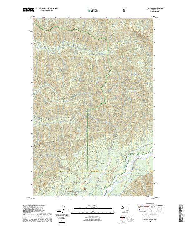
2023 Map of Finley Creek
USGS Topo · Published 2023About this map
Sams River and Matheny Creek carve through the high elevations of the Olympic Mountains, defining a landscape managed by several federal agencies. This 2023 survey details the intersection of the Olympic National Park and the Olympic National Forest, alongside protected areas like the Olympic Wilderness and Colonel Bob Wilderness. The topography is dominated by prominent landforms such as Sams Ridge and Matheny Ridge, which separate the various drainage basins feeding into the larger water systems.
Find a feature on this map
31 named features on this map. Tap any name to fly to it.
Don’t see what you’re looking for? This feature index may not catch every label — zoom into the map to look around manually.
Map Details
Editions of this 2023 Finley Creek Map
This is the sole edition of this map. No revisions or reprints were ever made.
Other maps of this area

1921 · Quinault Lake
USGS Topo · 1:62,500

1921 · Satsop
USGS Topo · 1:62,500

1947 · Mt Christie
USGS Topo · 1:62,500

1950 · Mt Christie
USGS Topo · 1:62,500

1955 · Grisdale
USGS Topo · 1:62,500

1955 · Quinault Lake
USGS Topo · 1:62,500

1956 · Kloochman Rock
USGS Topo · 1:62,500

1958 · Seattle
USGS Topo · 1:250,000

1962 · Seattle
USGS Topo · 1:250,000
1988 · Shelton
USGS Topo · 1:100,000