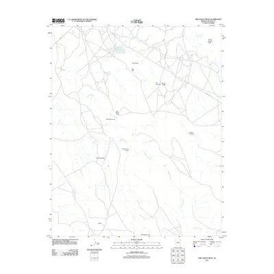
2011 Map of Fire Dance Mesa
USGS Topo · Published 2011About this map
Agua Sal Creek meanders through this landscape, providing a primary drainage route for the high desert mesas and ridges of the Chinle Agency region. The map highlights a network of geographic landmarks defined by their relationship to water and elevation, from the elevated Sitting Coyote Mesa in the northeast to the depths of Bihilinie Canyon and Yellowstone Canyon. Natural water sources like Broken Iron Spring and man-made features such as Round Rock Reservoir and Round Rock Lake demonstrate the critical infrastructure of the area.
Find a feature on this map
18 named features on this map. Tap any name to fly to it.
Don’t see what you’re looking for? This feature index may not catch every label — zoom into the map to look around manually.
Map Details
Editions of this 2011 Fire Dance Mesa Map
This is the sole edition of this map. No revisions or reprints were ever made.
Other maps of this area

1892 · Canyon De Chelly
USGS Topo · 1:250,000

1953 · Los Gigantes SE
USGS Topo · 1:24,000

1953 · Los Gigantes SW
USGS Topo · 1:24,000

1953 · Los Gigantes Buttes
USGS Topo · 1:62,500

1954 · Shiprock
USGS Topo · 1:250,000

1955 · Sonsala Butte 2 SW
USGS Topo · 1:24,000

1955 · Sonsala Butte 2 NW
USGS Topo · 1:24,000

1955 · Sonsala Butte 2 SE
USGS Topo · 1:24,000
1955 · Sonsala Butte 2 NE
USGS Topo · 1:24,000
1955 · Yellowstone Canyon
USGS Topo · 1:62,500