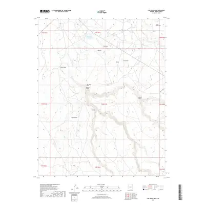
2018 Map of Fire Dance Mesa
USGS Topo · Published 2018About this map
Agua Sal Wash and its tributary Agua Sal Cr carve through this high desert landscape, defining the complex drainage patterns of the Chinle Agency region. The terrain is characterized by a series of prominent ridges and mesas, including the elevated Sitting Coyote Mesa and the distinctive Salt Water Cone. In the northern reaches, the Round Rock Reservoir provides a vital water source, while secluded spots like Broken Iron Spring indicate the critical locations of natural water in an otherwise arid environment.
Find a feature on this map
29 named features on this map. Tap any name to fly to it.
Don’t see what you’re looking for? This feature index may not catch every label — zoom into the map to look around manually.
Map Details
Editions of this 2018 Fire Dance Mesa Map
This is the sole edition of this map. No revisions or reprints were ever made.
Other maps of this area

1892 · Canyon De Chelly
USGS Topo · 1:250,000

1953 · Los Gigantes SE
USGS Topo · 1:24,000

1953 · Los Gigantes SW
USGS Topo · 1:24,000

1953 · Los Gigantes Buttes
USGS Topo · 1:62,500

1954 · Shiprock
USGS Topo · 1:250,000

1955 · Sonsala Butte 2 SW
USGS Topo · 1:24,000

1955 · Sonsala Butte 2 NW
USGS Topo · 1:24,000

1955 · Sonsala Butte 2 SE
USGS Topo · 1:24,000
1955 · Sonsala Butte 2 NE
USGS Topo · 1:24,000
1955 · Yellowstone Canyon
USGS Topo · 1:62,500