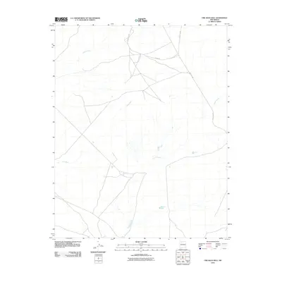
2010 Map of Fire Rock Well
USGS Topo · Published 2010About this map
Escavada Wash and Gallo Wash traverse a high-desert landscape in the Eastern Navajo Agency, defining the drainage patterns of this arid New Mexico region. The terrain is marked by the winding course of Cañada Alemita, which meanders through the southeast, cutting through a series of subtle topographic rises. A sparse network of unpaved tracks, including County Rd-7910 and Road 7970, provides the only modern infrastructure through the territory. This 2010 survey by the U.S. Geological Survey captures a quiet corner of the state where water resources like Dike Pit Tank are critical markers on the land. The presence of these named washes and isolated water tanks highlights the essential relationship between hydrology and land use in this open rangeland environment.
Find a feature on this map
8 named features on this map. Tap any name to fly to it.
Don’t see what you’re looking for? This feature index may not catch every label — zoom into the map to look around manually.
Map Details
Editions of this 2010 Fire Rock Well Map
This is the sole edition of this map. No revisions or reprints were ever made.
Other maps of this area

1883 · Mt. Taylor
USGS Topo · 1:250,000

1886 · Mt. Taylor
USGS Topo · 1:250,000

1889 · Largo
USGS Topo · 1:250,000

1892 · Mt. Taylor
USGS Topo · 1:250,000

1895 · Largo
USGS Topo · 1:250,000

1899 · Mt. Taylor
USGS Topo · 1:250,000

1954 · Aztec
USGS Topo · 1:250,000

1958 · Aztec
USGS Topo · 1:250,000

1958 · Albuquerque
USGS Topo · 1:250,000

1960 · Pueblo Alto Trading Post
USGS Topo · 1:24,000