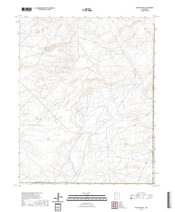
2023 Map of Fire Rock Well
USGS Topo · Published 2023About this map
Escavada Wash and Gallo Wash define the drainage patterns of this high-desert landscape in the San Juan Basin. The terrain is marked by a complex network of seasonal watercourses, including the notable Cañada Alemita, which carves through the southern portion of the quadrangle. Human activity is evidenced by a sparse grid of rural infrastructure, such as Co Rd 7970 and Co Rd 7900, which provide access to this isolated region of San Juan County. The presence of the Dike Pit Tank suggests the importance of water management for local land use. This modern survey reflects the enduring character of the New Mexico badlands, where the natural hydrography remains the primary structural element of the map.
Find a feature on this map
15 named features on this map. Tap any name to fly to it.
Don’t see what you’re looking for? This feature index may not catch every label — zoom into the map to look around manually.
Map Details
Editions of this 2023 Fire Rock Well Map
This is the sole edition of this map. No revisions or reprints were ever made.
Other maps of this area

1883 · Mt. Taylor
USGS Topo · 1:250,000

1886 · Mt. Taylor
USGS Topo · 1:250,000

1889 · Largo
USGS Topo · 1:250,000

1892 · Mt. Taylor
USGS Topo · 1:250,000

1895 · Largo
USGS Topo · 1:250,000

1899 · Mt. Taylor
USGS Topo · 1:250,000

1954 · Aztec
USGS Topo · 1:250,000

1958 · Aztec
USGS Topo · 1:250,000

1958 · Albuquerque
USGS Topo · 1:250,000

1960 · Pueblo Alto Trading Post
USGS Topo · 1:24,000