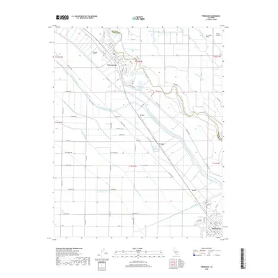
2018 Map of Firebaugh
USGS Topo · Published 2018About this map
The San Joaquin River winds through the heart of this Central California agricultural corridor, anchoring a complex network of irrigation and transit systems between Firebaugh and Mendota. The landscape is defined by its massive water-moving infrastructure, including the Delta-Mendota Canal and various lifts such as the First Lift Canal and Main Lift. These engineering feats dominate the terrain, running alongside historic routes like the Santa Fe Grade.
Find a feature on this map
89 named features on this map. Tap any name to fly to it.
Don’t see what you’re looking for? This feature index may not catch every label — zoom into the map to look around manually.
Map Details
Editions of this 2018 Firebaugh Map
This is the sole edition of this map. No revisions or reprints were ever made.
Other maps of this area

1913 · Panoche
USGS Topo · 1:125,000

1921 · Mendota
USGS Topo · 1:31,680

1922 · Oxalis
USGS Topo · 1:31,680

1922 · Tufts Ranch
USGS Topo · 1:31,680

1922 · Pozo Farm
USGS Topo · 1:31,680

1922 · Kentucky Well
USGS Topo · 1:31,680

1922 · Chaney Ranch
USGS Topo · 1:31,680

1923 · Wisdom Well
USGS Topo · 1:31,680

1923 · Firebaugh
USGS Topo · 1:31,680

1924 · Tranquillity
USGS Topo · 1:31,680