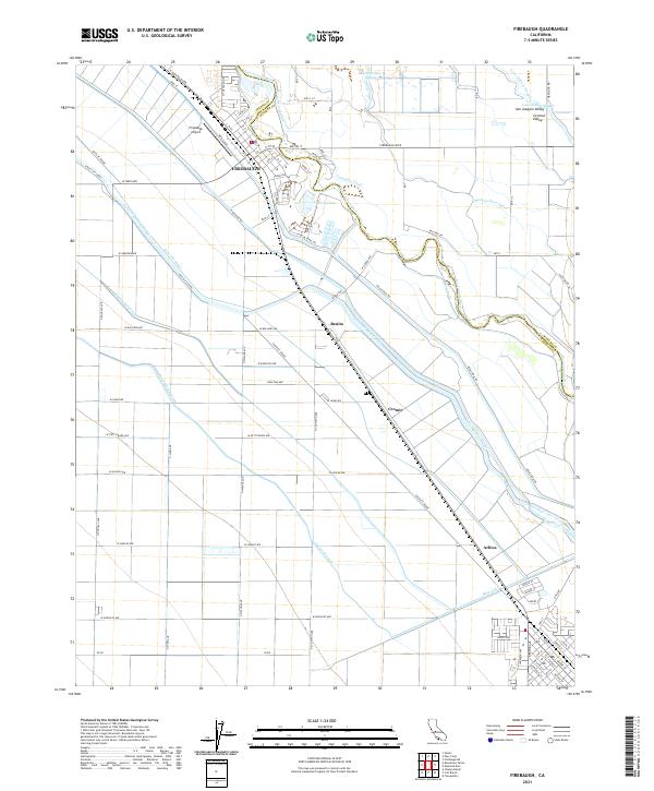
2021 Map of Firebaugh
USGS Topo · Published 2021About this map
The Firebaugh settlement sits at a critical junction of water and transport in the Central Valley, where the San Joaquin River defines the border between Fresno and Madera counties. This 2021 survey illustrates a landscape deeply engineered for agriculture, dominated by a complex network of irrigation and transport arteries. Major infrastructure including the Delta-Mendota Canal, the Columbia Canal, and several lift systems like the Main Lift reflect the region's total dedication to water management. Beyond the main town, smaller named locales such as Benito, Cromir, and Arbios appear along the Santa Fe Grade, marking the historic rail-aligned corridor through the valley. Local landmarks like the Firebaugh Airport and Lake Joallan provide additional points of reference amidst the vast grid of orchards and fields that characterize this productive reach of the valley.
Find a feature on this map
84 named features on this map. Tap any name to fly to it.
Don’t see what you’re looking for? This feature index may not catch every label — zoom into the map to look around manually.
Map Details
Editions of this 2021 Firebaugh Map
This is the sole edition of this map. No revisions or reprints were ever made.
Other maps of this area

1913 · Panoche
USGS Topo · 1:125,000

1921 · Mendota
USGS Topo · 1:31,680

1922 · Oxalis
USGS Topo · 1:31,680

1922 · Tufts Ranch
USGS Topo · 1:31,680

1922 · Pozo Farm
USGS Topo · 1:31,680

1922 · Kentucky Well
USGS Topo · 1:31,680

1922 · Chaney Ranch
USGS Topo · 1:31,680

1923 · Wisdom Well
USGS Topo · 1:31,680

1923 · Firebaugh
USGS Topo · 1:31,680

1924 · Tranquillity
USGS Topo · 1:31,680