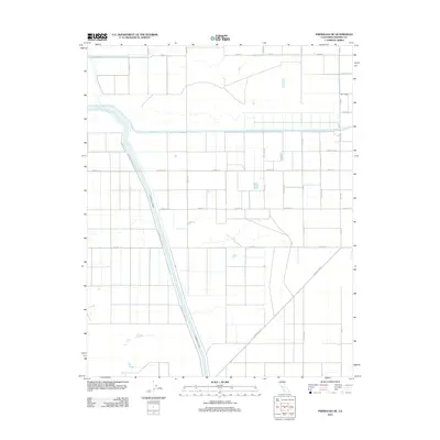
2012 Map of Firebaugh NE
USGS Topo · Published 2012About this map
The Fresno River meanders across this Central Valley landscape in Madera County, its natural course juxtaposed against the rigid geometry of the region's agricultural development. This 2012 survey illustrates the sophisticated water management systems essential to the area, dominated by the prominent Chowchilla Canal and the Aliso Canal that slice diagonally through the grid. The map reveals an intricate network of rural roads, such as Avenue 17 and Road 15, which define the section lines and irrigation blocks of this productive farm country. Near the southern boundary, the orientation of Firebaugh Blvd and Chowchilla Canal Rd provides a clear view of the transportation corridors connecting these fields to nearby markets. Away from the primary canals, smaller drainages like Dry Creek mark the natural topography of the valley floor before it was shaped by modern engineering.
Find a feature on this map
23 named features on this map. Tap any name to fly to it.
Don’t see what you’re looking for? This feature index may not catch every label — zoom into the map to look around manually.
Map Details
Editions of this 2012 Firebaugh NE Map
This is the sole edition of this map. No revisions or reprints were ever made.
Other maps of this area

1916 · Berenda
USGS Topo · 1:31,680

1918 · Bliss Ranch
USGS Topo · 1:31,680

1918 · Chowchilla
USGS Topo · 1:31,680

1918 · Berenda
USGS Topo · 1:31,680

1920 · Bonita Ranch
USGS Topo · 1:31,680

1921 · Mendota
USGS Topo · 1:31,680

1921 · Bonita Ranch
USGS Topo · 1:31,680

1922 · Pozo Farm
USGS Topo · 1:31,680

1922 · Kentucky Well
USGS Topo · 1:31,680

1923 · Firebaugh
USGS Topo · 1:31,680