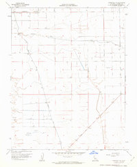
1961 Map of Firebaugh NE
USGS Topo · Published 1962About this map
Fresno River and the Chowchilla Canal dominate this agricultural stretch of the San Joaquin Valley, where water management defines the landscape. The intricate network of gridded roads, including Avenue 17 and Road 11, reflects a highly organized irrigation and farming economy in the early 1960s. Low-lying drainage areas like Berenda Slough and Dry Creek cross the terrain, while specialized land uses appear in the form of a Gun Club and several Gas Wells scattered near the Duck Pond. This survey captures the transition of the valley floor into a modern hydraulic environment, punctuated by rural infrastructure like an Airstrip and various siphons and wells that sustained the region's productivity during this era of post-war development.
Find a feature on this map
19 named features on this map. Tap any name to fly to it.
Don’t see what you’re looking for? This feature index may not catch every label — zoom into the map to look around manually.
Map Details
Editions of this 1961 Firebaugh NE Map
2 editions found
Other maps of this area

1916 · Berenda
USGS Topo · 1:31,680

1918 · Bliss Ranch
USGS Topo · 1:31,680

1918 · Chowchilla
USGS Topo · 1:31,680

1918 · Berenda
USGS Topo · 1:31,680

1920 · Bonita Ranch
USGS Topo · 1:31,680

1921 · Mendota
USGS Topo · 1:31,680

1921 · Bonita Ranch
USGS Topo · 1:31,680

1922 · Pozo Farm
USGS Topo · 1:31,680

1922 · Kentucky Well
USGS Topo · 1:31,680

1923 · Firebaugh
USGS Topo · 1:31,680