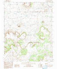
1991 Map of First Flat Mesa
USGS Topo · Published 1991About this map
The high desert terrain of the Hopi Indian Reservation and Navajo Indian Reservation dominates this landscape, defined by dramatic mesas and intermittent water sources. The map provides a detailed view of First Flat Mesa and Second Flat Mesa, two prominent landforms that have served as cultural and geographical anchors for generations. Between these elevations, the Ha-whi-yalin Wash cuts through the plains, eventually reaching Mud Flat to the east. This 1991 provisional survey documents the vital water points necessary for life in this arid environment, including Cottonwood Spring, Rainbow Spring, and Coyote Spring. To the north, the isolated Stephen Butte rises near the reservation boundary, while the Hopi Buttes provide further geological complexity to the south, illustrating the intricate relationship between tribal boundaries and the natural topography of the Colorado Plateau.
Find a feature on this map
12 named features on this map. Tap any name to fly to it.
Don’t see what you’re looking for? This feature index may not catch every label — zoom into the map to look around manually.
Map Details
Editions of this 1991 First Flat Mesa Map
This is the sole edition of this map. No revisions or reprints were ever made.
Other maps of this area

1883 · Tusayan
USGS Topo · 1:250,000

1886 · Tusayan
USGS Topo · 1:250,000

1947 · Flagstaff
USGS Topo · 1:250,000

1954 · Flagstaff
USGS Topo · 1:250,000

1958 · Flagstaff
USGS Topo · 1:250,000

1960 · Flagstaff
USGS Topo · 1:250,000

1962 · Flagstaff
USGS Topo · 1:250,000

1966 · White Cone
USGS Topo · 1:62,500

1966 · Egloffstein Butte
USGS Topo · 1:62,500
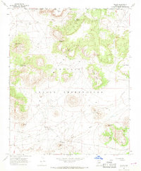
1967 · Dilkon
USGS Topo · 1:24,000