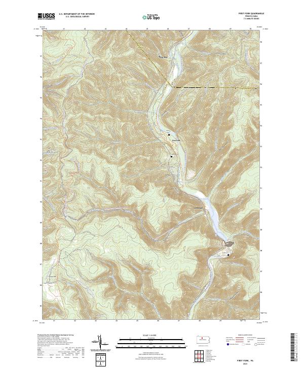
2023 Map of First Fork
USGS Topo · Published 2023About this map
First Fork Sinnemahoning Creek dominates the valley floor of this modern survey, cutting through the high plateaus of Potter County and Cameron County. Small settlements like First Fork and Lushbaugh are clustered along 1st Fork Rd, reflecting a landscape where human habitation remains concentrated in the narrow bottomlands. Local heritage is preserved in sites like the Gilmore Cem and Smith Cem, which stand near the creek's edge.
Find a feature on this map
64 named features on this map. Tap any name to fly to it.
Don’t see what you’re looking for? This feature index may not catch every label — zoom into the map to look around manually.
Map Details
Editions of this 2023 First Fork Map
This is the sole edition of this map. No revisions or reprints were ever made.
Other maps of this area

1945 · Driftwood
USGS Topo · 1:48,000

1945 · First Fork
USGS Topo · 1:24,000

1945 · Sinnemahoning
USGS Topo · 1:24,000

1945 · Driftwood
USGS Topo · 1:24,000

1945 · Cameron
USGS Topo · 1:24,000

1946 · Renovo West
USGS Topo · 1:62,500

1946 · Hammersley Fork
USGS Topo · 1:24,000

1946 · Keating
USGS Topo · 1:24,000

1947 · Cameron
USGS Topo · 1:24,000

1947 · First Fork
USGS Topo · 1:24,000
Featured Places
- Wharton Township, PA
- Gibson Township, PA
- Lumber Township, PA
- Grove Township, PA
- First Fork, Grove Township