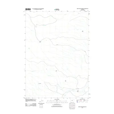
2012 Map of First Water Draw
USGS Topo · Published 2012About this map
First Water Draw defines the drainage patterns of this high-plains landscape in Natrona County. The terrain is characterized by a series of distinct topographic forms, from the expansive Beaton Basin in the west to the prominent Black Rim and Taylor Slope in the east. These landforms dictate the course of local waterways such as Eagle Cr and its S Fork Eagle Cr, which carve through the northern section of the map, while Buffalo Cr dominates the southern reaches near Buffalo Creek Rd.
Find a feature on this map
14 named features on this map. Tap any name to fly to it.
Don’t see what you’re looking for? This feature index may not catch every label — zoom into the map to look around manually.
Map Details
Editions of this 2012 First Water Draw Map
This is the sole edition of this map. No revisions or reprints were ever made.
Other maps of this area

1952 · Deadman Butte
USGS Topo · 1:24,000

1952 · Grave Spring
USGS Topo · 1:24,000

1955 · Arminto
USGS Topo · 1:250,000

1958 · Arminto
USGS Topo · 1:250,000

1961 · Barnum
USGS Topo · 1:62,500

1962 · Arminto
USGS Topo · 1:250,000

1967 · Gordon Creek
USGS Topo · 1:24,000
1967 · Cherry Creek Hill
USGS Topo · 1:24,000

1968 · First Water Draw
USGS Topo · 1:24,000

1968 · Roughlock Hill
USGS Topo · 1:24,000