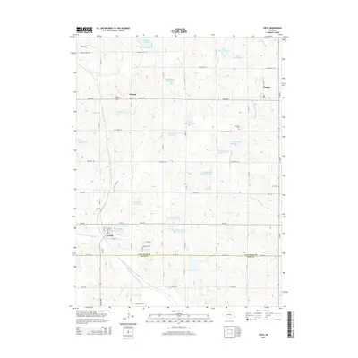
2014 Map of Firth
USGS Topo · Published 2014About this map
Hickman and Firth anchor this section of Southeast Nebraska, where the landscape is defined by the transition between the Middle Br Big Nemaha River and the rolling terrain of the Lancaster and Gage county line. The region is characterized by a high concentration of water management features, including several reservoirs such as Hedgefield Reservoir and the N F Big Nemaha Reservoir 23-B system, reflecting the vital role of water control in this agricultural heartland.
Find a feature on this map
45 named features on this map. Tap any name to fly to it.
Don’t see what you’re looking for? This feature index may not catch every label — zoom into the map to look around manually.
Map Details
Editions of this 2014 Firth Map
This is the sole edition of this map. No revisions or reprints were ever made.
Other maps of this area

1897 · Lincoln
USGS Topo · 1:125,000

1903 · Weeping Water
USGS Topo · 1:125,000

1929 · Weeping Water
USGS Topo · 1:125,000

1955 · Lincoln
USGS Topo · 1:250,000

1957 · Lincoln
USGS Topo · 1:250,000

1958 · Lincoln
USGS Topo · 1:250,000

1964 · Cortland
USGS Topo · 1:24,000

1964 · Pickrell
USGS Topo · 1:24,000

1964 · Roca
USGS Topo · 1:24,000

1965 · Adams
USGS Topo · 1:24,000