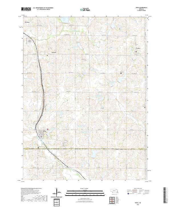
2021 Map of Firth
USGS Topo · Published 2021About this map
Hickman and Firth anchor this section of southern Nebraska, where the drainage divide between the Salt Creek and Big Nemaha River systems shapes the local landscape. The map reveals a highly managed watershed defined by a series of reservoirs, including Wagon Train Lake, Hedgefield Reservoir, and Van Pelt Reservoir. These water bodies are interspersed with established rural communities like Holland and Panama, which maintain a distinct presence amid the grid-like road network. Genealogists will find significant value in the documentation of several local burial grounds, such as Holland Cem, Panama Cem, Pella Cem, and Firth Cem. The inclusion of the Rusty Crankshaft Airport northwest of Holland adds a contemporary aviation landmark to this agricultural region, while the N Fork Big Nemaha River and Middle Br Big Nemaha River trace the natural topography of the southern townships.
Find a feature on this map
53 named features on this map. Tap any name to fly to it.
Don’t see what you’re looking for? This feature index may not catch every label — zoom into the map to look around manually.
Map Details
Editions of this 2021 Firth Map
This is the sole edition of this map. No revisions or reprints were ever made.
Other maps of this area

1897 · Lincoln
USGS Topo · 1:125,000

1903 · Weeping Water
USGS Topo · 1:125,000

1929 · Weeping Water
USGS Topo · 1:125,000

1955 · Lincoln
USGS Topo · 1:250,000

1957 · Lincoln
USGS Topo · 1:250,000

1958 · Lincoln
USGS Topo · 1:250,000

1964 · Cortland
USGS Topo · 1:24,000

1964 · Pickrell
USGS Topo · 1:24,000

1964 · Roca
USGS Topo · 1:24,000

1965 · Adams
USGS Topo · 1:24,000