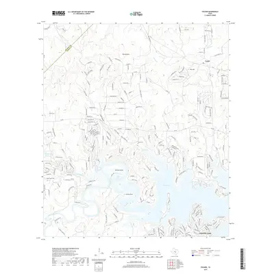
2019 Map of Fischer
USGS Topo · Published 2019About this map
Canyon Lake dominates the southern landscape of this Hill Country study, where the Guadalupe River enters the reservoir near Rust Falls. This 2019 survey documents a region defined by its water sources and limestone topography, featuring numerous historic water points like Rebecca Springs, Cranes Mill Springs, Wolfe Springs, and Bishop Spring. The small community of Fischer is situated in the north, connected to the surrounding rugged terrain by FM 32 and Fischer Store Rd.
Find a feature on this map
213 named features on this map. Tap any name to fly to it.
Don’t see what you’re looking for? This feature index may not catch every label — zoom into the map to look around manually.
Map Details
Editions of this 2019 Fischer Map
This is the sole edition of this map. No revisions or reprints were ever made.
Other maps of this area

1887 · Blanco
USGS Topo · 1:125,000

1894 · Blanco
USGS Topo · 1:125,000

1920 · Smithsons Valley
USGS Topo · 1:62,500

1925 · Hunter No 3
USGS Topo · 1:48,000

1925 · Smithson Valley No. 1
USGS Topo · 1:48,000

1927 · Smithson Valley
USGS Topo · 1:62,500

1929 · Hunter
USGS Topo · 1:62,500

1929 · Smithson Valley
USGS Topo · 1:62,500

1940 · Smithson Valley
USGS Topo · 1:62,500

1954 · Llano
USGS Topo · 1:250,000