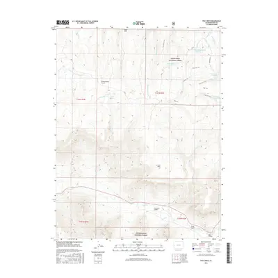
2016 Map of Fish Creek
USGS Topo · Published 2016About this map
Grand Mesa National Forest and Uncompahgre National Forest dominate this high-altitude landscape of Western Colorado, where complex water management systems serve the lower valleys. The map documents a sophisticated network of catchments and conveyances, including Fruita Waterworks Reservoir Number 2 and several other numbered reservoirs linked by trails such as the Haypress Trail and Reservoir #1 Trail. This infrastructure illustrates the vital relationship between the high plateaus and the arid agricultural lands below.
Find a feature on this map
33 named features on this map. Tap any name to fly to it.
Don’t see what you’re looking for? This feature index may not catch every label — zoom into the map to look around manually.
Map Details
Editions of this 2016 Fish Creek Map
This is the sole edition of this map. No revisions or reprints were ever made.
Other maps of this area

1949 · Gateway
USGS Topo · 1:24,000

1950 · Pine Mountain
USGS Topo · 1:24,000

1952 · Gateway
USGS Topo · 1:24,000

1956 · Moab
USGS Topo · 1:250,000

1959 · Moab
USGS Topo · 1:250,000

1960 · Moab
USGS Topo · 1:250,000
1960 · Gateway
USGS Topo · 1:62,500
1960 · Gateway
USGS Topo · 1:24,000
1960 · Pine Mountain
USGS Topo · 1:24,000

1962 · Moab
USGS Topo · 1:250,000