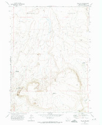
1971 Map of Fish Fin Rim
USGS Topo · Published 1974About this map
Fish Fin Rim and the prominent Big Fish Fin anchor this high desert landscape within Catlow Valley. The region is defined by its water management for livestock, with a network of scattered resources including East Gulch Waterhole, Rimrock Waterhole, and Beach Top Waterhole providing essential points in the arid terrain. These features, along with several Wells and the Three Lakes Waterhole, illustrate the infrastructure required for ranching in Harney County during the early 1970s.
Find a feature on this map
13 named features on this map. Tap any name to fly to it.
Don’t see what you’re looking for? This feature index may not catch every label — zoom into the map to look around manually.
Map Details
Editions of this 1971 Fish Fin Rim Map
2 editions found
Other maps of this area

1955 · Adel
USGS Topo · 1:250,000

1957 · Adel
USGS Topo · 1:250,000

1958 · Adel
USGS Topo · 1:250,000

1962 · Adel
USGS Topo · 1:250,000

1971 · Fish Fin Rim
USGS Topo · 1:24,000

1971 · Beatys Butte
USGS Topo · 1:24,000

1971 · Surveyors Lake
USGS Topo · 1:24,000

1971 · Blitzen
USGS Topo · 1:24,000

1971 · Coyote Gap SE
USGS Topo · 1:24,000

1971 · Mahogany Butte
USGS Topo · 1:24,000