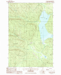
1985 Map of Fish River Lake
USGS Topo · Published 1986About this map
Fish River Lake dominates this portion of the North Woods, serving as a central hub for the remote sporting and logging landscape of northern Maine. The map illustrates a wilderness economy transition, where seasonal recreation at Moose Point Camps and the Boat Landing sits alongside active resource extraction, evidenced by several Gravel Pit sites and a network of Private Road access routes. Distinctive landforms like Zella Island and Blueberry Island break the surface of the lake, while the surrounding terrain is defined by the drainage basins of Chase Brook, Smith Brook, and the Fish River. The township boundaries, such as T 14 R 8 Wels, reflect the historic West of the East Line of the State surveying system, highlighting the area's identity as unorganized territory primarily managed for timber and seasonal residency.
Find a feature on this map
26 named features on this map. Tap any name to fly to it.
Don’t see what you’re looking for? This feature index may not catch every label — zoom into the map to look around manually.
Map Details
Editions of this 1985 Fish River Lake Map
This is the sole edition of this map. No revisions or reprints were ever made.
Other maps of this area

1928 · Winterville
USGS Topo · 1:48,000

1930 · Greenlaw
USGS Topo · 1:48,000

1931 · Fish River Lake
USGS Topo · 1:48,000

1931 · Mooseleuk Lake
USGS Topo · 1:48,000

1931 · Winterville
USGS Topo · 1:62,500

1933 · Greenlaw
USGS Topo · 1:62,500

1935 · Fish River Lake
USGS Topo · 1:62,500

1935 · Mooseleuk Lake
USGS Topo · 1:62,500

1954 · Presque Isle
USGS Topo · 1:250,000

1958 · Presque Isle
USGS Topo · 1:250,000