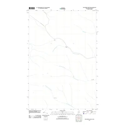
2011 Map of Fish River Lake SW
USGS Topo · Published 2011About this map
St Francis Rd and W Side Echo Lake Rd provide the primary access through this heavily wooded portion of Aroostook County, where the landscape is defined by its network of brooks and remote seasonal outposts. Named locations such as Bouchers Camp, Joe Tardy Camp, and Soucys Camp are scattered along the watercourses and roads, indicating the area's long-standing use for timber harvesting or sporting. The drainage system is particularly well-defined, featuring the winding paths of North Branch Fox Brook, South Branch Fox Brook, and the Right Fork Twentymile Brook. Small water bodies like Mud Pond dot the terrain, while Smith Brook flows toward the eastern boundary, illustrating the complex hydrology of the North Woods.
Find a feature on this map
10 named features on this map. Tap any name to fly to it.
Don’t see what you’re looking for? This feature index may not catch every label — zoom into the map to look around manually.
Map Details
Editions of this 2011 Fish River Lake SW Map
This is the sole edition of this map. No revisions or reprints were ever made.
Other maps of this area

1931 · Fish River Lake
USGS Topo · 1:48,000

1931 · Mooseleuk Lake
USGS Topo · 1:48,000

1932 · Musquacook Lakes
USGS Topo · 1:48,000

1932 · Allagash Falls
USGS Topo · 1:48,000

1935 · Musquacook Lakes
USGS Topo · 1:62,500

1935 · Fish River Lake
USGS Topo · 1:62,500

1935 · Mooseleuk Lake
USGS Topo · 1:62,500

1935 · Allagash Falls
USGS Topo · 1:62,500

1954 · Presque Isle
USGS Topo · 1:250,000

1956 · Allagash Falls
USGS Topo · 1:50,000