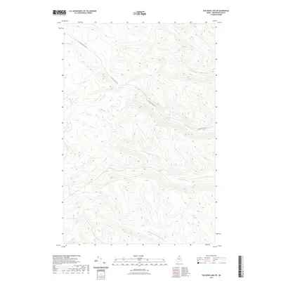
2021 Map of Fish River Lake SW
USGS Topo · Published 2021About this map
Mud Pond sits at the center of this remote Aroostook County landscape, serving as a catchment for the drainage networks that define the local topography. This 2021 survey documents a heavily forested region of Northern Maine where human infrastructure is limited to the W Side Echo Lake Rd, which winds through the northern elevations. The map is characterized by a dense system of waterways, including the N Br Fox Brook and S Br Fox Brook, alongside the Right Fork Twentymile Brook in the south. The complex contour lines illustrate a terrain of steep ridges and narrow valleys, typical of the unorganized territories where logging and seasonal recreation have historically shaped the land use. This specific quadrangle captures the headwaters and tributaries that eventually contribute to the Fish River drainage system.
Find a feature on this map
7 named features on this map. Tap any name to fly to it.
Don’t see what you’re looking for? This feature index may not catch every label — zoom into the map to look around manually.
Map Details
Editions of this 2021 Fish River Lake SW Map
This is the sole edition of this map. No revisions or reprints were ever made.
Other maps of this area

1931 · Fish River Lake
USGS Topo · 1:48,000

1931 · Mooseleuk Lake
USGS Topo · 1:48,000

1932 · Musquacook Lakes
USGS Topo · 1:48,000

1932 · Allagash Falls
USGS Topo · 1:48,000

1935 · Musquacook Lakes
USGS Topo · 1:62,500

1935 · Fish River Lake
USGS Topo · 1:62,500

1935 · Mooseleuk Lake
USGS Topo · 1:62,500

1935 · Allagash Falls
USGS Topo · 1:62,500

1954 · Presque Isle
USGS Topo · 1:250,000

1956 · Allagash Falls
USGS Topo · 1:50,000