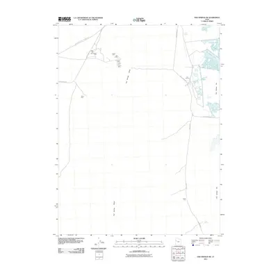
2011 Map of Fish Springs SW
USGS Topo · Published 2011About this map
Pony Express and Overland Stge history is preserved on this 2011 survey of Juab County, showing the intersection of frontier transport and high-desert mining. The map documents a concentration of extraction sites along the eastern slopes of the Fish Springs Range, including the Utah Mine, Galena Mine, and Cactus Mine. These operations are supported by complex infrastructure like the Early Harvest Shaft and Joseph Adit. In contrast to the arid mountain slopes, the eastern portion of the sheet features the wetlands of Fish Springs Flat. This area is defined by a series of springs and pools, such as Pintail Pool and Mallard Pool, alongside notable water features like Thomas Springs and the uniquely named Devils Hole. These vital water sources provided the necessary lifeblood for the Pony Express Rd as it crossed this demanding environment.
Find a feature on this map
26 named features on this map. Tap any name to fly to it.
Don’t see what you’re looking for? This feature index may not catch every label — zoom into the map to look around manually.
Map Details
Editions of this 2011 Fish Springs SW Map
This is the sole edition of this map. No revisions or reprints were ever made.
Other maps of this area

1908 · Fish Springs
USGS Topo · 1:250,000

1910 · Fish Springs
USGS Topo · 1:250,000

1953 · Delta
USGS Topo · 1:250,000

1958 · Delta
USGS Topo · 1:250,000

1960 · Granite Mountain
USGS Topo · 1:62,500

1962 · Delta
USGS Topo · 1:250,000

1967 · Sand Pass NW
USGS Topo · 1:24,000

1967 · Fish Springs NW
USGS Topo · 1:24,000

1967 · Fish Springs SE
USGS Topo · 1:24,000
1967 · Sand Pass NE
USGS Topo · 1:24,000