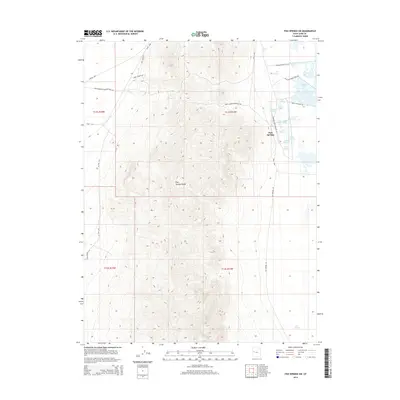
2014 Map of Fish Springs SW
USGS Topo · Published 2014About this map
Historic transportation routes intersect along the northern edge of the Fish Springs Range in this western Utah desert landscape. The Lincoln Hwy and the Pony Express-Overland Stage Trl represent two distinct eras of American cross-country travel, skirting the high ground where industrial remnants like Early Shaft Rd and Drill Hole Rd suggest a history of subsurface exploration. To the east, the terrain drops toward the Fish Springs wetland complex, where numerous groundwater sources including Thomas Springs, Mirror Spring, and Walter Spring sustain a network of managed water bodies such as Shoveler Pool and Mallard Pool. This contrast between the arid canyons of W Fish Cyn and the vital springs illustrates the importance of reliable water for travelers and wildlife in the Great Basin.
Find a feature on this map
32 named features on this map. Tap any name to fly to it.
Don’t see what you’re looking for? This feature index may not catch every label — zoom into the map to look around manually.
Map Details
Editions of this 2014 Fish Springs SW Map
This is the sole edition of this map. No revisions or reprints were ever made.
Other maps of this area

1908 · Fish Springs
USGS Topo · 1:250,000

1910 · Fish Springs
USGS Topo · 1:250,000

1953 · Delta
USGS Topo · 1:250,000

1958 · Delta
USGS Topo · 1:250,000

1960 · Granite Mountain
USGS Topo · 1:62,500

1962 · Delta
USGS Topo · 1:250,000

1967 · Sand Pass NW
USGS Topo · 1:24,000

1967 · Fish Springs NW
USGS Topo · 1:24,000

1967 · Fish Springs SE
USGS Topo · 1:24,000
1967 · Sand Pass NE
USGS Topo · 1:24,000