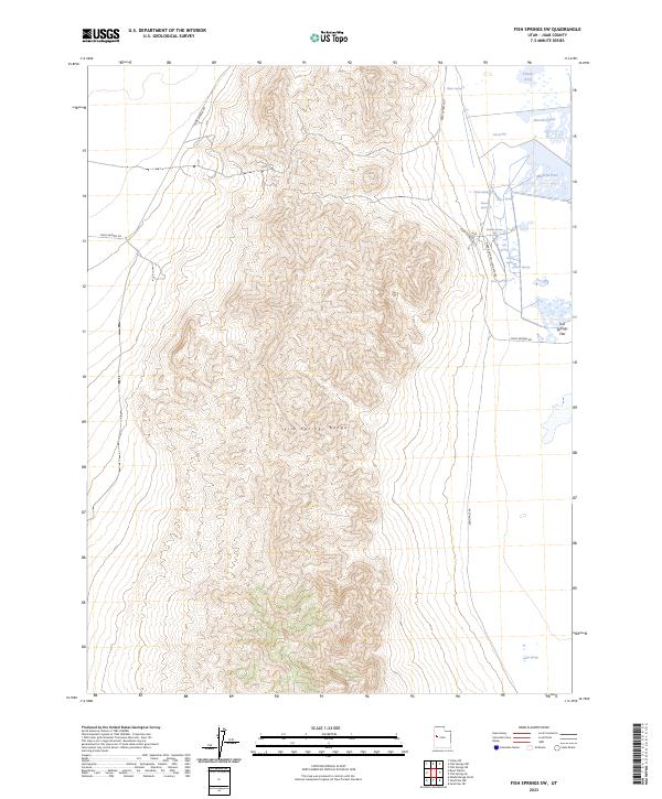
2023 Map of Fish Springs SW
USGS Topo · Published 2023About this map
The Fish Springs National Wildlife Refuge dominates the northeastern corner of this landscape, where the arid Great Basin environment gives way to a critical network of spring-fed wetlands. Fed by sources such as Fish Springs and Walter Spring, a series of managed impoundments including Pintail Pool, Shoveler Pool, and Mallard Pool provide a stark contrast to the surrounding desert. This water system is contained by the Fish Springs Flat, bordered to the west by the steep, rising elevations of the Fish Springs Range.
Find a feature on this map
20 named features on this map. Tap any name to fly to it.
Don’t see what you’re looking for? This feature index may not catch every label — zoom into the map to look around manually.
Map Details
Editions of this 2023 Fish Springs SW Map
This is the sole edition of this map. No revisions or reprints were ever made.
Other maps of this area

1908 · Fish Springs
USGS Topo · 1:250,000

1910 · Fish Springs
USGS Topo · 1:250,000

1953 · Delta
USGS Topo · 1:250,000

1958 · Delta
USGS Topo · 1:250,000

1960 · Granite Mountain
USGS Topo · 1:62,500

1962 · Delta
USGS Topo · 1:250,000

1967 · Sand Pass NW
USGS Topo · 1:24,000

1967 · Fish Springs NW
USGS Topo · 1:24,000

1967 · Fish Springs SE
USGS Topo · 1:24,000
1967 · Sand Pass NE
USGS Topo · 1:24,000