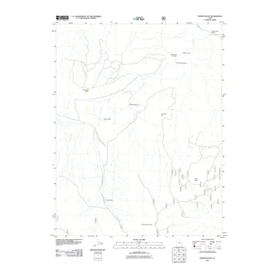
2011 Map of Fisher Valley
USGS Topo · Published 2011About this map
Fisher Valley and the high desert plateaus of Grand County are defined by a network of drainage systems and isolated tablelands in this early 21st-century survey. The landscape is dominated by the prominent Polar Mesa to the east and Sevenmile Mesa to the northwest, with the Dolores River cutting through the northeast corner near Cottonwood Canyon. Transport through this arid terrain relies on a sparse system of tracks including Onion Creek and Hideout Rd and Mesa Rd, which provide access to remote areas like Hideout Canyon and Cowhead Hill. The drainage patterns of Fisher Creek and Onion Creek illustrate the erosional forces that have shaped the region's topography, while North Beaver Mesa marks the southern extent of the quadrangle's elevated terrain.
Find a feature on this map
18 named features on this map. Tap any name to fly to it.
Don’t see what you’re looking for? This feature index may not catch every label — zoom into the map to look around manually.
Map Details
Editions of this 2011 Fisher Valley Map
This is the sole edition of this map. No revisions or reprints were ever made.
Other maps of this area

1885 · La Sal
USGS Topo · 1:250,000

1954 · Mt. Waas 4 SE
USGS Topo · 1:24,000

1954 · Mt. Waas 4 SW
USGS Topo · 1:24,000

1954 · Mt. Waas 4 NE
USGS Topo · 1:24,000

1954 · Mt. Waas 4 NW
USGS Topo · 1:24,000

1954 · Mt. Waas 3 NE
USGS Topo · 1:24,000

1954 · Mt. Waas 3 SE
USGS Topo · 1:24,000

1954 · Mt. Waas 1 SW
USGS Topo · 1:24,000

1954 · Mt. Waas 1 SE
USGS Topo · 1:24,000

1954 · Coates Creek
USGS Topo · 1:62,500