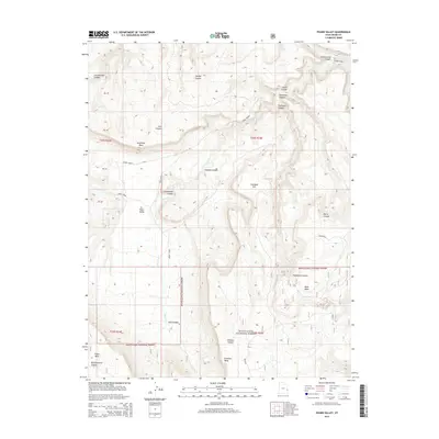
2014 Map of Fisher Valley
USGS Topo · Published 2014About this map
Fisher Valley and its surrounding canyonlands appear here in high detail, defined by a complex drainage system feeding into the Dolores River at the northeast corner of the sheet. The landscape is dominated by massive elevated formations including Sevenmile Mesa, Polar Mesa, and N Beaver Mesa, while the depths of Cottonwood Canyon and Bridge Canyon carve through the high desert. Much of the southern and eastern portions of the map are protected within the Manti-LaSal National Forest, where the topography becomes increasingly intricate near Bunchground Canyon. A network of primitive routes like Rose Garden and Mesa Rd provide the only access through this terrain, tracing the paths of Onion Creek and Fisher Cr. This 2014 survey documents the enduring physical geography of this remote section of Grand County, showing how the drainage patterns of Hideout Canyon and Thompson Canyon shape the local environment.
Find a feature on this map
32 named features on this map. Tap any name to fly to it.
Don’t see what you’re looking for? This feature index may not catch every label — zoom into the map to look around manually.
Map Details
Editions of this 2014 Fisher Valley Map
This is the sole edition of this map. No revisions or reprints were ever made.
Other maps of this area

1885 · La Sal
USGS Topo · 1:250,000

1954 · Mt. Waas 4 SE
USGS Topo · 1:24,000

1954 · Mt. Waas 4 SW
USGS Topo · 1:24,000

1954 · Mt. Waas 4 NE
USGS Topo · 1:24,000

1954 · Mt. Waas 4 NW
USGS Topo · 1:24,000

1954 · Mt. Waas 3 NE
USGS Topo · 1:24,000

1954 · Mt. Waas 3 SE
USGS Topo · 1:24,000

1954 · Mt. Waas 1 SW
USGS Topo · 1:24,000

1954 · Mt. Waas 1 SE
USGS Topo · 1:24,000

1954 · Coates Creek
USGS Topo · 1:62,500