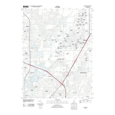
2010 Map of Fishers
USGS Topo · Published 2010About this map
The White River winds through this landscape, dividing the maturing residential expansions of Carmel and Fishers during a period of rapid suburban densification. The terrain is marked by a complex network of planned subdivisions and golf courses, such as Plum Creek Golf Course and Sahm Golf Course, which replaced earlier agricultural fields. Connectivity is defined by the intersection of major thoroughfares near Castleton, where the infrastructure accommodates heavy transit through Allisonville and Ivy Hills.
Find a feature on this map
138 named features on this map. Tap any name to fly to it.
Don’t see what you’re looking for? This feature index may not catch every label — zoom into the map to look around manually.
Map Details
Editions of this 2010 Fishers Map
This is the sole edition of this map. No revisions or reprints were ever made.
Other maps of this area

1948 · Indianapolis East
USGS Topo · 1:24,000

1948 · Indianapolis West
USGS Topo · 1:24,000

1952 · Cumberland
USGS Topo · 1:24,000

1952 · Fishers
USGS Topo · 1:24,000

1952 · Carmel
USGS Topo · 1:24,000

1952 · Mc Cordsville
USGS Topo · 1:24,000

1953 · Westfield
USGS Topo · 1:24,000

1953 · Riverwood
USGS Topo · 1:24,000

1953 · Noblesville
USGS Topo · 1:24,000

1953 · Cincinnati
USGS Topo · 1:250,000