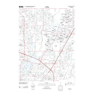
2013 Map of Fishers
USGS Topo · Published 2013About this map
The White River carves a serpentine path through this 2013 landscape, defining the character of a rapidly developing suburban corridor north of Indianapolis. Evidence of the area's agricultural and early industrial past is still visible at Stevenson Mill, while the modern infrastructure of the Indianapolis Metropolitan Airport and the Marion County Bridge 0501F represent the region's contemporary growth. The river itself remains a central feature, punctuated by White Horse Rapids and crossed by the Eller Bridge.
Find a feature on this map
109 named features on this map. Tap any name to fly to it.
Don’t see what you’re looking for? This feature index may not catch every label — zoom into the map to look around manually.
Map Details
Editions of this 2013 Fishers Map
This is the sole edition of this map. No revisions or reprints were ever made.
Other maps of this area

1948 · Indianapolis East
USGS Topo · 1:24,000

1948 · Indianapolis West
USGS Topo · 1:24,000

1952 · Cumberland
USGS Topo · 1:24,000

1952 · Fishers
USGS Topo · 1:24,000

1952 · Carmel
USGS Topo · 1:24,000

1952 · Mc Cordsville
USGS Topo · 1:24,000

1953 · Westfield
USGS Topo · 1:24,000

1953 · Riverwood
USGS Topo · 1:24,000

1953 · Noblesville
USGS Topo · 1:24,000

1953 · Cincinnati
USGS Topo · 1:250,000