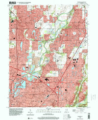
1998 Map of Fishers
USGS Topo · Published 2000About this map
The White River carves through the heart of this Hamilton and Marion County landscape, serving as a boundary for the developing residential and commercial corridors between Carmel and Fishers. By the late 1990s, the area reflects a significant suburban shift, with numerous golf courses and planned subdivisions like Newark Village and Northwood Hills surrounding the river's bend. Notable cultural sites are preserved here, including the Conner Prairie Museum and Lynnwood Farm, which stand in contrast to the rapid expansion of Indianapolis as it pushes northward through Castleton and Allisonville.
Find a feature on this map
83 named features on this map. Tap any name to fly to it.
Don’t see what you’re looking for? This feature index may not catch every label — zoom into the map to look around manually.
Map Details
Editions of this 1998 Fishers Map
This is the sole edition of this map. No revisions or reprints were ever made.
Other maps of this area

1948 · Indianapolis East
USGS Topo · 1:24,000

1948 · Indianapolis West
USGS Topo · 1:24,000

1952 · Cumberland
USGS Topo · 1:24,000

1952 · Fishers
USGS Topo · 1:24,000

1952 · Carmel
USGS Topo · 1:24,000

1952 · Mc Cordsville
USGS Topo · 1:24,000

1953 · Westfield
USGS Topo · 1:24,000

1953 · Riverwood
USGS Topo · 1:24,000

1953 · Noblesville
USGS Topo · 1:24,000

1953 · Cincinnati
USGS Topo · 1:250,000