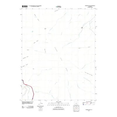
2010 Map of Fishers Peak
USGS Topo · Published 2010About this map
Fisher Peak Mesa dominates this landscape in southern Las Animas County, where the high plains meet the dramatic volcanic uplifts near the New Mexico border. The settlement of San Miguel sits in the northeast along the waters of San Miguel Creek, while the southwestern corner is defined by the drainage of Raton Creek and the corridor of Interstate 25. This survey highlights a network of vital water sources in a semi-arid environment, including First Spring, Second Spring, and Pearl Spring, which served as critical points for cattle and wildlife. Canyons such as Moores Canyon and Coblett Canyon carve through the mesa edges, leading to distinct plateaus like Big Flat and Marion Flat. The map reveals how the geography shaped local life, with family-named locations like Cassidays Spring and the prominent landmark of Fishers Peak anchoring the high-altitude terrain.
Find a feature on this map
34 named features on this map. Tap any name to fly to it.
Don’t see what you’re looking for? This feature index may not catch every label — zoom into the map to look around manually.
Map Details
Editions of this 2010 Fishers Peak Map
This is the sole edition of this map. No revisions or reprints were ever made.
Other maps of this area

1891 · Spanish Peaks
USGS Topo · 1:125,000

1892 · Elmoro
USGS Topo · 1:125,000

1893 · Spanish Peaks
USGS Topo · 1:125,000

1893 · Elmoro
USGS Topo · 1:125,000

1895 · Spanish Peaks
USGS Topo · 1:125,000

1897 · Elmoro
USGS Topo · 1:125,000

1897 · Spanish Peaks
USGS Topo · 1:125,000

1900 · Spanish Peaks
USGS Topo · 1:125,000

1912 · Raton
USGS Topo · 1:62,500

1914 · Raton
USGS Topo · 1:62,500