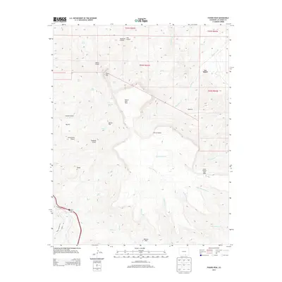
2013 Map of Fishers Peak
USGS Topo · Published 2013About this map
Fishers Peak dominates this Southern Colorado landscape, marking a high volcanic plateau south of Trinidad. The 2013 survey illustrates a transition from the mesa top down through complex drainage systems like Coalbank Canyon and Nile Canyon. Small settlements and locales such as Engleville, San Miguel, and Cañocito are situated along the lower elevations and creek beds. The map details a sophisticated network of water sources essential for this arid region, including Pearl Spring, Sager Spring, and Cassidays Spring. These features, along with the extensive system of intermittent streams like Schwackheim Cr and San Miguel Cr, reveal the historic importance of water rights and topographic management in Las Animas County. The inclusion of Bartlett Mesa and Little Fishers Peak Mesa highlights the area's distinctive flat-topped geology and steep escarpments.
Find a feature on this map
44 named features on this map. Tap any name to fly to it.
Don’t see what you’re looking for? This feature index may not catch every label — zoom into the map to look around manually.
Map Details
Editions of this 2013 Fishers Peak Map
This is the sole edition of this map. No revisions or reprints were ever made.
Other maps of this area

1891 · Spanish Peaks
USGS Topo · 1:125,000

1892 · Elmoro
USGS Topo · 1:125,000

1893 · Spanish Peaks
USGS Topo · 1:125,000

1893 · Elmoro
USGS Topo · 1:125,000

1895 · Spanish Peaks
USGS Topo · 1:125,000

1897 · Elmoro
USGS Topo · 1:125,000

1897 · Spanish Peaks
USGS Topo · 1:125,000

1900 · Spanish Peaks
USGS Topo · 1:125,000

1912 · Raton
USGS Topo · 1:62,500

1914 · Raton
USGS Topo · 1:62,500